
Model description
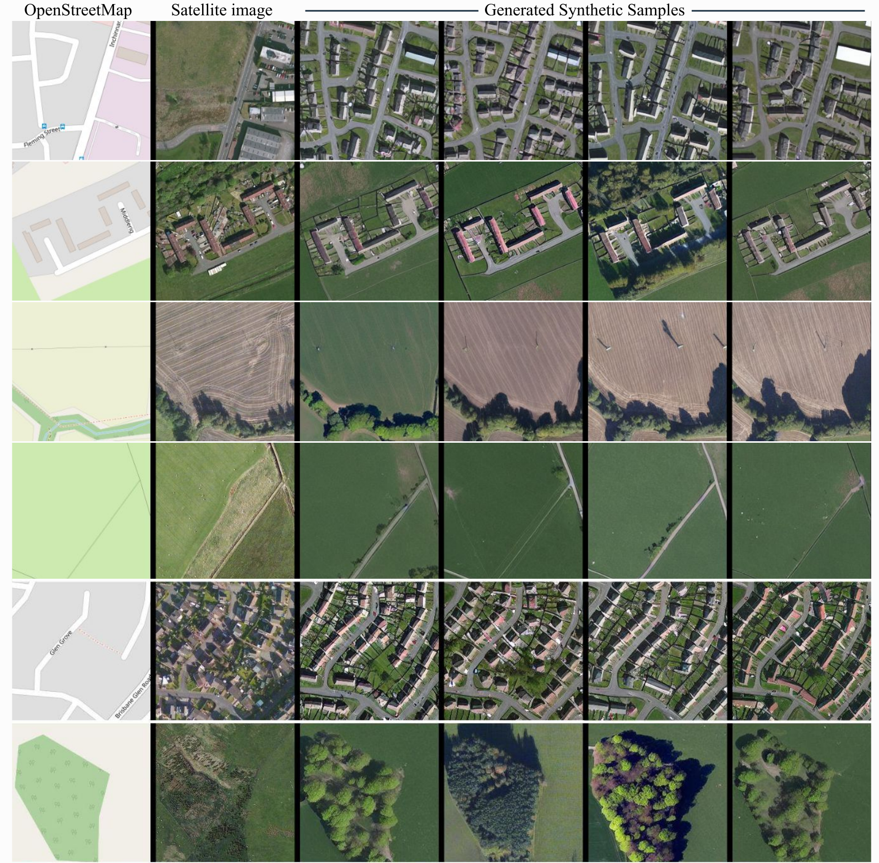
ControlNet model conditioned on OpenStreetMaps (OSM) to generate the corresponding satellite images.
Trained on the region of the Central Belt.
Dataset used for training
The dataset used for the training procedure is the WorldImagery Clarity dataset.
The code for the dataset construction can be accessed in https://github.com/miquel-espinosa/map-sat.
- Downloads last month
- 2
Inference Providers
NEW
This model is not currently available via any of the supported third-party Inference Providers, and
HF Inference API was unable to determine this model’s pipeline type.